Factors affecting data
resolution
- resolutions of satellite data for
the different channels are valid at the earth's
position directly below the satellite. This
location on the earth is called the satellite
subpoint.
- The satellite footprint is the
area currently being scanned by the satellite.
Think of the footprint as being similar to
the area being photographed with a camera.
|
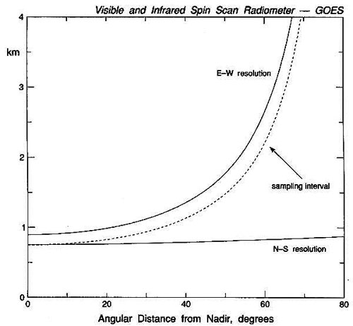
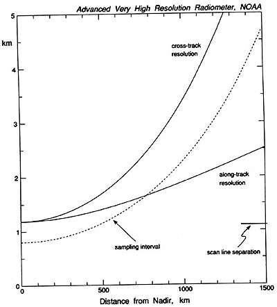
- The size of the footprint gets
larger when it is further to the east or west
from nadir. Nadir is the angle of the
footprint from the subpoint location.
Accordingly, the resolution gets worse with
increasing nadir angle. Here are the
footprint resolutions for GOES and Polar orbiting satellites
as a function of nadir angle.
- Decreasing resolution is a
function of:
- Curvature of the earth
- to a lesser extent, the
increasing distance of the footprint from
the satellite.
- Data at angles greater than 60°
are not very useful
|