Forecasting with Surface Weather Charts
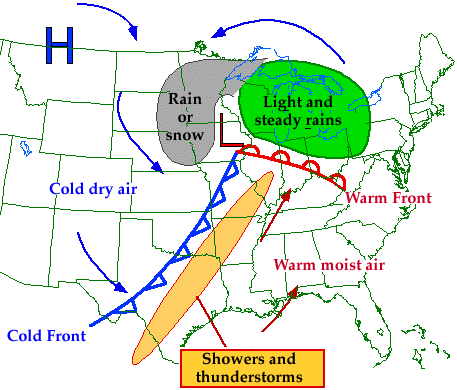
Given that we know the weather associated with common features on a surface weather chart, for example:
- cold front - narrow band of showers
- NE of warm front - light/moderate wide spread precip.
- warm sector - hot, humid
- etc.
if we can predict the movement of these feature based on its previous motion, we can then make a forecast with this information.
So, determining movement of weather systems is quite important for forecasting.
How is it done?
 image from WW2010 Online
Guides